Tag Archive: southwest

A Grand Tour of Arizona’s Past Cultures and Ancient Ruins

How you arrange this tour depends a lot on where you are coming from. I came from Utah in the North, many others will be coming from Phoenix. or Las Vegas. Either way, you can draw almost a circle of travel, from just north of Flagstaff down to Sedona, and Phoenix, and then up through Globe and Winslow, and finally to Chinle on the Navajo reservation, and then back to Flagstaff.

Stop #1: Wupatki National Monument (NE of Flagstaff)

Wupatki offers ready access to five major sets of ruins, Lomaki and Box Canyon Pueblos, Citadel and Nalakihu, Wupatki, and Wukoki. Wupatki, which the park is named after is by far the most extensive, but each has its own appeal. My other favorites besides Wupatki, were the Citadel, and Wukoki. Wukoki is of particular interesting at sunset.

The ruins of Wupatki were inhabited by the Ancestral Puebloans more than 900 years ago. It’s hard to imagine, given how arid the area is, that the Indians of these dwellings were able to sustainably farm corn, beans, squash and cotton for any length of the time. But the ruins stand as a testament to their resilience and ingenuity.

Official Website

Stop #2: Walnut Canyon National Monument

Just south of Flagstaff, is a cliff dwelling once occupied by a group of people called the Sinagua, by the Spanish. Sinagua means “without water”. The Spanish when they visited the area, were surprised that not only had people been able to live in such a harsh place, but that the high San Francisco Mountains didn’t offer the amount of water they were expecting, compared to similar high mountains in arid parts of Spain.

Official Website

Stop #3: Sedona and the Verde Valley

If there was a heartland of the Sinagua people it would be the Verde Valley and the surrounding canyon regions around Sedona. It’s been estimated that as many as 6,000 people lived in the region at the height of the Sinagua civilization, in dozens of pueblos, many with hundreds of rooms. In one case, a ruin called Chavez Pass, had over 1000 rooms.

Today, much of the recognizable evidence of their existence has been lost, due to erosion, floods, and occupation of the region by others, including white settlers. However, there are a number of spectacular ruins that still exist.

Montezuma Castle - Verde Valley - Arizona

Montezuma Castle – Verde Valley – Arizona

Montezuma Castle – This is one of the best-preserved cliff dwellings of any Ancestral Puebloan culture in the southwest. The 20+ room structure owes its resilience, no doubt to the dry climate, its placement high in a cliff alcove away from the elements, and a bit of luck.

Official Website

Tuzigoot National Monument – When archaeologist found this, the pueblo was largely in ruins and buried under dirt. What visitors see today is a reconstruction of the walls from the material at the site. The pueblo at its tallest stands three stories and comprises more than 100 rooms that were built in stages from 1125 to 1400 CE.

Official Website

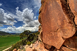
Palatki and Honanki Heritage Sites – Both of these sites, located near each other, are examples of Sinagua Cliff Dwellings. Likely habitation of the sites occurred between 1130 and 1280 CE, but there is evidence from nearby pictographs that people had been visiting the area since at least 2000 BC.

One note. If you plan to visit the Palatki site, access to the ruins is available by guided tours only, and you must have a reservation beforehand.

Palatki Website / Honanki Website

Montezuma Well – While not as spectacular as the other ruins mentioned in the Verde Valley,  Montezuma Well holds a special significance to the tribes (past and present) that have called the Verde Valley home. Both the Hopi, and Yavapai consider Montezuma Well as the starting point in their origin myths.  And it’s not difficult to see why. Nearly 1.5 million gallons of water flow consistently from this natural spring each day, providing a source of water that has been used for at least 10,000 years.  An irrigation ditch built to reach farm fields below the spring has existed long enough that its original shape has been preserved by the dissolved limestone that has been deposited along its length.

Official Website

Stop #4: Casa Grande (Coolidge, AZ)

Casa Grande Hohokam Ruin

Casa Grande Hohokam Ruin

I must admit that my first inclination as a photographer was to give Casa Grande a pass on my trip through Arizona. The large protective cover that stands over this building was a bit of turn off, but I am glad I changed my mind.  It’s hard to understand without looking at it in person just how massive this building, with amazingly thick walls, really is. And it’s all made out of mud.

Casa Grande is a product of the Hohokam Culture, that by some estimates occupied the Phoenix and Tucson Basins as far back as 2000 B.C. Casa Grande is a product of the final stage of the Hohokam Culture, known as Pueblo IV, which lasted until roughly 1450 A.D. It’s estimated that its height, the Hohokam, through their extensive canal system, irrigated as much as 19,000 acres of the land surrounding the nearby Gila River. And in the larger region of Arizona they inhabited, the estimated acreage goes over 100,000. Their crops included; corn, beans, squash, tobacco, cotton, barley and amaranth.  Even today, as you drive through the area on your way to the site, you will come across fields filled with cotton, a homage of sorts to the past.

There are two Hohokam-related sites, located closer to Phoenix that many will find of interest. They include Mesa Grande, and Pueblo Grande, which offers recreations of how Hohokam buildings and villages might have looked. Both reside close to the Salt River, a tributary to the Gila River, and the main river that flows through the Phoenix area.

Official Website

Stop #5: Besh-Ba-Gowah Archaeological Park (Globe, AZ)

Besh-Ba-Gowah is a 200-room, partially reconstructed pueblo of the Salado people of the Tonto basin, who lived in the area between 1150 AD and the 1400’s. The Tonto basin roughly covers the area surrounding what is now the Roosevelt Lake, a reservoir completed in 1911.

Official Website

Stop #6: Tonto National Monument

Tonto National Monument was created in 1907, it seems as a compromise of sorts, to forever preserve a piece of the history of the Salado people located in two cliff dwellings high above the valley where the majority of Salado had lived, and which the waters of Roosevelt Lake now covers over.

Official Website

Stop #7:  Agate House – Petrified Forest National Park

Among its many natural treasures, Petrified Forest National Park also contains numerous reminders of its past inhabitants. This includes a group of Ancestral Puebloans that used petrified wood to construct an 8-room Pueblo known as Agate House.  The unique pueblo was reconstructed by archaeologist Cornelius B. Cosgrove.

Official Website

Stop #8: Canyon De Chelly National Park  (Chinle, AZ)

This part of Arizona has been occupied by many different groups of Indians over time, including the Anasazi, the Hopi, and most recently the Navajo. The Canyon reflects this heritage with archaeological remains from all three cultures. The most prominent, however, are the cliff dwellings of the Anasazi. Much of the canyon floor is off limits to visitors without a Navajo guide or park ranger.  The one exception is the famous White House Ruin, which is about a 2-mile round trip hike from the rim of the canyon.  The canyon, however, contains more than 2500 archaeological sites, and the remains of dozens of Anasazi villages. And artifacts have been found, that date back to at least 1500 B.C.

Official Website

Videos:
Travel Guide

Stop #9: Navajo National Monument

This park is managed by the Navajo Nation, and contains a couple of famous, well preserved Anasazi Ruins. The first Betatakin requires a guided 3-5 mile hike (depending on the trail taken). The second ruin can be founded at the end of a 17-mile hike. While a guide is not required, you must obtain a permit to visit the site, and only 20 permits are given out each day during the summer season. Both ruins are closed during the winter (October-April).

Other Possibilities

If you made it as far as the Navajo National Monument, or Canyon De Chelly and have extra time on your hands, I highly recommend extending your journey into the Four Corners region. Possibilities include Aztec Ruin NM, and Chaco Canyon NP in New Mexico, Mesa Verde, and Canyon of the Ancients in Colorado, and Bears Ears, and Hovenweep National Monuments in Utah. All of these are within a few hours drive of one another and showcase the fantastic architecture left behind by the Anasazi.

Top Pictograph/Petroglyph Sites in Utah

McConkie Ranch Petroglyph - Utah

McConkie Ranch Petroglyph – Utah

For rock art hunters, Utah offers a veritable playground to explore, with hundreds, if not thousands of sites open to discovery. Some locations are well known, while others take a significant effort in both time and research to find. And I like many avid rock art enthusiats tend to keep the lesser known sites close to the vest. I do it for two reasons…half the fun is the research and discovery process. Nothing that is handed to you is as rewarding as finding it yourself. And second, there is little doubt that some among us hold this ancient art in less regard than others. Which has led to widespread vandalism of some of the more well known and easily accessible sites. With that, plenty can be said that will help those interested in exploring the wilds of Utah, and discovering a little bit of the history carved and painted on its sandstone walls.

Pictographs vs. Petroglyphs

What is the difference between a pictograph and petroglyph?. The answer lies in the tools used to create the art. Pictographs are essentially paintings, using varies pigments that produce different colors. Ochre was a widely used example that produces earthy shades of orange and red. But explore enough and you’ll find other colors like white, yellow, blue and green. On the other hand, Petroglyph were created by artists that used rocks and other blunt instruments to chip a design out of their sandstone canvas.

In my experience different tribes at different periods of time seemed to favor one style over the other. But it would be incorrect to say that pictographs were created by one group of Indians, and petroglyphs by another. As there example of both styles being used at the same time, and taking on the same artistic characteristics and subjects.

What is the rock art telling us?

At this point nobody knows precisely, and chance are good we never will. There is no equivalent to the Rosetta Stone in North American archaeology, and even if one were found, the rock art one finds in Utah and throughout the American Southwest is spread over such a vast period of time, and many different cultures that one translation wouldn’t fit them all.That being said, I don’t think we need to look farther than our own lives to get a sense of what the ancient Native Americans were recording in the sandstone. Like us they were human beings with aspirations, struggles, and questions about their place in the Universe.

If you look closely enough at the rock art and make some educated guesses you will see at least three different things.

The Natural World
There are repeated depictions of animals found in the real world. Bighorn sheep, snakes, buffalo, deer, elk and lizards. No doubt the Indians saw these as either a food source, a predator to be wary of, or both.  If you look at the Native American mythology of today you can also imagine these creatures taking on a spiritual or earthly mythological component. The oral traditions of the Raven and Coyote as a trickster that one sees in modern tribes is a good example.

The Spirit World
As noted above, there also seems to be a clear spiritual, or mythological component to the rock art that depicts creatures and anthropomorphic figures that are clearly not realistic representations of something found on Earth in the present or during the period ancient Indian tribes lived in the West. No doubt these creatures find their origin in dreams, oral stories and spiritual beliefs about the world and the broader universe. Similar examples of such creatures can be found in the mythology of ancient Greece, the Norse, the Irish, etc.

The Celestial World
Finally, research has demonstrated that certain markings left behind were related to celestial events and observations. Such as arrows and other markers painted or carved onto rock faces where the sunlight only falls on key days of the astronomical calendar, such as the Summer and Winter Solstices, and the Spring and Fall Equinoxes. These markings alone tell us the Native Americans were keen observers of the night sky, and knew lunar, solar and constellation cycles well.

Different Rock Art Styles/Traditions

At least three major groups were involved in producing the rock art found in Utah.

Archaic Indian Period (7500 B.C. to 300 A.D.?)
One of the major producers of pictograph rock art in Utah were a group of hunters and gathers known as Archaic Indians that lived in Utah from about 7500 B.C. until possibly as recent as 300 A.D. The art they left behind is known as the Barrier Canyon Style, whose name is derived from Barrier Canyon (now called Horseshoe Canyon) which lies to the west of Moab in an extension of Canyonlands National Park. Dating estimates for BCS seem to vary widely and are based on the difficult task of radiocarbon dating pigments and rock falls.

Fremont /Anasazi Indian Period (100 A.D.-1300 A.D.)

While the Fremont and the Anasazi were very distinct groups, they shared a number of similar characteristics, including a semi-nomadic lifestyle that incorporated village life and farming with active hunting and gathering. They also share a common time frame, which is why I group them together here. In general, I think it can be said that petroglyphs were there preferred form of expression, but pictographs including handprint displays have been attributed to them.

Ute Indian Period (1300 A.D. – 1880 A.D.)

The Ute Indian rock art is best distinguished from earlier art by the depiction of horses and their riders, as well as other more realistic depictions of animals, humans, etc. While horses were once native to North America they became extinct eons before humans arrived. Their depiction in recent petroglyphs provides a fairly precise date no earlier than the arrival of the Spanish, who were the first to bring horses back to the Western Hemisphere.

Popular Utah Rock Art Sites

Sego Canyon
I mention Sego Canyon first because its a bit unique in my experience, offering three distinct displays of rock art from the time periods described above. This allows the visitor to easily compare the different styles. Sego Canyon is located north of Moab and close to Utah’s border with Colorado off I-70. Just find Thompson Springs north of the highway, and follow its main road toward the Book Cliffs. Signs will direct you the rest of the way. Keep in mind that while part of the land containing petroglyphs is owned by the BLM, some are also on private land.

Horseshoe Canyon
This canyon contains what has been described as the “Michelangelo” of North American rock art – the Great Gallery. Within Horseshoe Canyon (once called Barrier Canyon) resides the largest and best-preserved examples of the Barrier Canyon Style, in a series of rock art panels. The Great Gallery the largest of the panels and over 200 feet in length, has anthropomorphs as tall as 7 feet and more than a half dozen of a similar height. The access point to Horseshoe Canyon is a dirt road on the opposite side of the highway from the entrance to Goblin Valley. Look for signs to Horseshoe Canyon. In dry weather, the road can be traveled by any well-maintained vehicle with proper precaution. The road is about 30 miles, and the hike into the canyon is 7 miles round trip. The best time to enter the canyon is in the early morning, this will help you to avoid most of the afternoon heat when you exit, and the sun should be in a good spot for photograph most of the panels.

McConkie Ranch (Dry Fork Canyon)
McConkie Ranch is to the Fremont Petroglyph legacy what Horseshoe Canyon was to the Archaic Indians. Hands down this along with Horseshoe Canyon are the most amazing petroglyph/pictograph sites I have ever visited. The petroglyphs are varied, detailed, pristine, and in some cases very large. However, unlike the other sites mentioned here, this one is entirely on private land, which for now remains open to those who respect the site and its owners. However, as was indicated to me that could change at any time. So if you haven’t been here before I highly recommend visiting sooner rather than later. And when you go, if you are lucky you might get to see their collection of arrowheads, spear points, baskets, and metates.

Newspaper Rock
Newspaper Rock is probably the best known and most widely photographed petroglyph panel in the United States. It features an array of different creatures, anthropomorphs, and symbols from a variety of different cultures. The Archaic Indians, Fremont, Anasazi, Navajo and other Ancestral Puebloan cultures have all visited the site and left their mark over the ages. This particular panel is located on the southern edge of Canyonlands, along SR211 which leads to the Needles section of the park.

Rochester Panel
This panel is mostly of Fremont origin but also displays art from other tribes, explorers, Mormon pioneers and unfortunately tourists. The acts of the latter though should not dissuade you from a visit,  as it is equal in caliber to Newspaper Rock in the amount and variety of art displayed in one spot. The panel is located just west of the San Rafael swell and east of the town of Emery.

Nine Mile Canyon
Nine Mile Canyon, located just north of Wellington in central Utah, was a vast artistic canvas for Fremont and Ute Indians. Its claim to fame is the sheer quantity of rock art that can be found along the canyon’s 46-mile length. To date over 1000 archaeological sites have been cataloged, including petroglyphs, dwelling ruins, and grain stores. Examples of rock art include – Big Buffalo, Mickey Mouse, The Great Hunt, and the Sand Hill Crane Panel.

Moab Area
A variety of rock art can be found close to Moab, most of it outside the boundaries of Canyonlands and Arches. Cultures represented in the different panels include the Archaic Indians, the Fremont, and Utes. Examples include Moab Man, Intestine Man, and Wolf Ranch

San Rafael Swell
The San Rafael Swell is a fairly vast area in central Utah and split by Interstate 70. While its known most for its amazing geologic display, it was also home to the Archaic and Fremont Indians. If you have the time and know how to survive Utah’s brutal desert conditions, this is one place that if you spend enough time you will likely find something few have ever seen. Well known rock art locations include – Molen Reef Snake, Buckhorn Wash, Head of Sinbad, and Black Dragon Wash.

McKee Springs (Dinosaur National Monument)
The McKee Springs petroglyphs have been attributed to the Fremont Indians, who lived in the park over a thousand years ago. To reach the petroglyphs requires travel north of the Park’s main Utah entrance, and entering via the Island Park Road. The road should be in good condition during dry weather, but it is primarily dirt.  The Island Park area is also known for remnants left behind by European pioneers and is an access point for boaters traveling on the Green River.

Suggested Reading:

A Field Guide to Rock Art Symbols of the Greater Southwest – Alex Patterson
Ancient Peoples of the Great Basin and Colorado Plateau – Steven R. Simms

Top Ancient Archaeological Sites in the United States

doll-house-anasazi-ruin-utah-gary-whitton

The following are a list of ancient Native American archaeological sites, many of them of the ancient Anasazi (known more recently as Ancestral Puebloan). I have organized the list by the most visually stunning and well preserved, rather than by their cultural and historical significance. The dominance of the Ancestral Puebloans is as much attributable I believe to the preserving nature of deserts as it is to their characterstic of building monumental buildings. Many of these sites have been protected as state and national parks and are located primarily in the Western United States around the Four Corners region of Colorado, Utah, New Mexico and Arizona. If you only had one opportunity to visit these ancient American sites, a trip that covered this area of the Southwest would be well worth it. And they are within a 4-5 hour drive of three international airports – Salt Lake City, Albuquerque, and Phoenix.

Mesa Verde

Mesa Verde Nationa Park - Cliff Palace

Cliff Palace/Wikipedia

Located in the Southwest corner of Colorado, just outside Cortez, Mesa Verde is without a doubt the largest and best preserved ancient Native American ruins in North America, north of the Mexican border. A major settlement area for the Anasazi Indians (also known as Ancestral Puebloans) between 650 A.D. and 1285 A.D., much of the monumental architecture from the latest period of occupation can be found in a series of desert sandstone canyons with giant south facing alcoves turned into cliff dwellings. Cliff Palace, the largest of the dwellings contained at its height 150 rooms and 23 kivas, and housed an estimated 100 people.

At least 6 other major ruins are located in the park, with dozens of other sites within the canyons as well as the mesa top. These include Balcony, Long, Mug, Oak Tree, Spruce Tree and Square Tower Houses.

Mesa Verde NP: Website
Google Maps: Find
Flickr: Photo Gallery
Book: 
The Lost World of the Old Ones: Discoveries in the Ancient SouthwestDavid Roberts
Radio West: Author discussion of The Lost World of the Old Ones.

Chaco Canyon

Pueblo Bonito Anasazi Ruin - New Mexico

Pueblo Bonito – Wikipedia

Like Mesa Verde, Chaco Canyon’s 15 major archaeological sites are a product of the Ancestral Puebloeans. Located south of Mesa Verde in northern New Mexico, it contained the largest buildings in the United States until the 19th century. The largest of these, Pueblo Bonito, covers 3 acres and contains close to 800 rooms. However archaeological, and climatic research suggests that Chaco may have been intended more as a  gathering place for religious ceremonies, than an attempt to build a large permanent settlement. The design and alignment of many of the buildings suggest that solar and lunar cycles played a significant role in their construction. This importance is mirrored in the petroglyphs found in the area, including famously those on Fajada Butte.

Another notable feature of the Chaco Canyon site is the network of roads that radiate from it across the San Juan Basin. The longest of these are the Great North and South Roads. Debate continues about other significant road segments in the area that are shorter and disconnected, that absent weathering over time, may have been connected in the past. Whatever the case, they hint both at the importance of Chaco Canyon, but also the significant effort that was required to bring materials from other area, like timber, to build the canyon’s monumental architecture.

Chaco Canyon NP: Website
Google Maps: Find
Archeoastronomy of the Chacoan Pueblo (PDF)

Cedar Mesa/Grand Gulch

Unlike Chaco Canyon and Mesa Verde, the Anasazi ruins in the Cedar Mesa/Grand Gulch cover a much larger area. The ruins are smaller and more dispersed, but finding them offers an intimate wilderness experience, with the real potential to see ancient relics that few others have. However the experience comes at a prices. Much of Cedar Mesa is a remote desert environment, with much of it accessible only by dirt roads that can change significantly with bad weather, and hiking trails that can prove challenging at times for the inexperienced and unprepared.

Some of the most famous ruins in the area include: Tower House, Fallen Roof, House on Fire, River House, Moon House and Jailhouse.

Grand Gulch: Official Website
Google Maps: Find
Fine Art America : Photo Gallery

Horseshoe Canyon Pictographs

Originally named Barrier Canyon, Horseshoe Canyon was designated as an offshoot of Canyonlands National Park (Utah) in 1971. It was included in the management of the park to help protect what is arguably the best preserved example of ancient Native American rock art. It is also some of the oldest known rock art, with most scientists agreeing the pictographs are at least 700 to 2000 years old. Some believe they are far older. The canyon’s rock art is considered the archetype, and best example of a rock art style known as the Barrier Canyon Style (BCS) seen in different spots across much of the Colorado plateau.

The main pictograph panel in the canyon, known as the Great Gallery is 200 feet long and 15 feet high, with over 20 life-sized anthropomorphic images. The tallest is over 7 feet high. Other notable panels in the canyon, include Horseshoe, Alcove, and High Gallery.  All are found along the same hiking trail, and relatively easy to find.

The access point for Horseshoe Canyon is opposite the entrance to Utah’s Goblin Valley State Park, and requires a well maintained 2-wheel drive vehicle with reasonable clearance for the 30+ mile drive to the canyon’s edge. Once at the trailhead the hike is 7 miles round trip with the hardest part being the hike out. Keep this in mind, especially during the hot summer months.

National Park Service – Horseshoe Canyon
Google Maps – Find
Fine Art America: Photo Gallery
Article: The Archaelogy of Horseshoe Canyon (National Park Service) (PDF)

Montezuma Castle

Montezuma Castle Camp Verde Arizona

Montezuma Castle – Wikipedia

Montezuma Castle is a well-preserved cliff dwelling of the Ancestral Puebloeans located near Camp Verde, Arizona. The dwellings were constructed and used by the Sinagua, a tribe closely related to the Hohokam. Montezuma is believed to have been constructed after 1100 A.D. following the resettlement of the Verde Valley by the Sinagua. The structure contains 20 different rooms and may have housed as many as 50 people. The last known occupation of the site was around 1425 A.D. And like the Anasazi its believed that drought, and possibly warfare forced the Sinagua to migrate to other locations.

While the ruin is named after the Aztec King Montezuma, there are no known direct links to the Aztec’s themselves, although possible trading links have been suggested by some historians.

National Park Service – Montezuma Castle
Google Maps – Find
Flickr: Photo Gallery

Canyon de Chelly

Canyon de Chelly is a National Park wholly owned by and located within the Navajo Reservation. It is named after a particular canyon within the park but consists of three – de Chelly, del Muerto, and Monument. The canyon system is considered one the longest continuously inhabited locations in North America , mostly recently by the Navajo and Anasazi. Within the canyon are a number of visible Anasazi ruins, including White House, Antelope House and Sliding House. Of these three, park visitors can visit White House in the company of a Navajo guide.  In addition, over 2500 archaeological sites have been identified in the area, including dozens of Anasazi village sites.

Located in the Northeast corner of Arizona, it makes a good stop on a tour of other nearby archaeological sites, including Mesa Verde, Cedar Mesa and Chaco Canyon.

National Park Service – Canyon De Chelly

Google Maps – Find

Wupatki

Wupatki Pueblo Ruins - Arizona

Wupatki Pueblo Ruins – Matt Kieffer

Wupatki National Monument is located in North Central Arizona near the town of Flagstaff. The park encloses archaeological sites from at least 3 distinct cultures, including the Cohonina, Kayenta Anasazi, and Sinagua. Wupatki Pueblo the ruin after which the monument is named is the oldest in the park and contained over 100 rooms. It also includes a ball court, a structure similar to those found in Mesoamerica, and suggestive of a link to tribes further south.

National Park Service – Wupatki National Monument

Google Maps – Find
Flickr: Photo Gallery

Serpent Mound

The Great Serpent Mound is a 1,348-foot long, three-foot-high prehistoric effigy mound located in Adams County Ohio. Managed as a park by the Ohio Historical society, the mound is believed to have been constructed by the Fort Ancient culture around 1070 A.D. The name of the culture is derived from the Fort Ancient archaeological site, located with Washington Township, Ohio. The Fort Ancient peoples are believed to have lived along the Ohio river from West Virginia to Kentucky between 1000-1750 A.D.

Ohio History Center – Serpent Mound
Google Maps – Find

Blythe Intaglios

The Blythe Intaglios (Geoglyphs) are a grouping of large figures, similar to the Nazca Lines of South America, near Blythe California. The largest figure is over 171 feet long. Similar figures albeit of a smaller nature can be found throughout the desert of Southeastern California. The glyphs were created by scraping away the top layer of soil which is darker color than the soil beneath. The Blythe figures are believed to range in age from 900 BCE to 1200 CE, based on radiocarbon dating. The tribe of people responsible for their creation has yet to be identified. Their meaning is more than likely spiritual in nature.

Bureau of Land Management – Blythe Intaglios
Google Maps – Find

James Jacob’s: Photo Gallery

Further Reading Suggestions: