Bonneville Salt Flats - Natural Wonder - Utah - Photographer's Guide
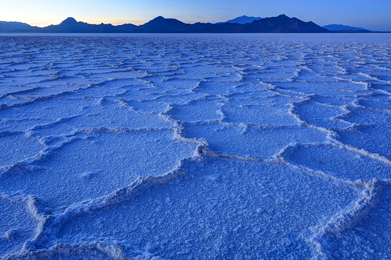
Google Maps | Purchase Print Located near Utah’s northwestern border with Nevada, the Bonneville Salt Flats are a geologic remnant of a much wetter time in Utah and the Great Basin. They along with the Great Salt Lake, Sevier Lake, and Utah Lake, were formed by Lake Bonneville, which at its greatest extent was more than 900 ft deep, and covered more than 19,000 square miles. Roughly the size of Lake Michigan. Lake Bonneville existed in one form or other for more than 12 million years, and lasted until 14,500 years ago. Though technically, since the lake has receded and grown dozens of times over its existence, one might be inclined to consider the present just one of those many phases, with the Great Salt Lake the largest remaining component. One of the most recent causes for the lake’s decline, was the breaking of an earthen dam (created by two converging alluvial fans) at Red Rock Pass, ID. This event led to a massive flood that emptied into the Snake and Columbia Rivers, and made the lake drop more than 300 ft. Ironically this wasn’t the only massive flood the Columbia River would experience during this rapid period of change, as another massive lake, Lake Missoula was undergoing similar cycles of decline and resurgence, as multiple glacial ice dams broke and reformed along the edge of the Pleistocene ice sheets to the north. Because of the uniform nature of the salt pan that covers the Bonneville Salt Flats it has become a world renowned location for racing high speed vehicles. Some have reached speeds has high as 400 mph. And for photographers, a section of the salt flats along I-80, offers a natural wonder to behold, especially at sunrise and sunset. There are really two different photographic opportunities here, and they generally...Read more
Ultimateplaces Photography