A Photographic Journey through the Scenic Colorado River Watershed - Photographer's Guide
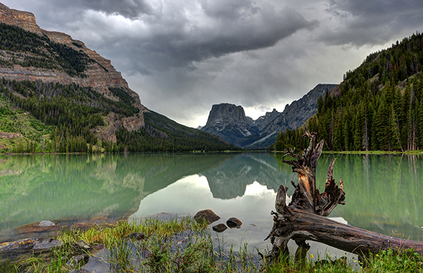
The Colorado River Basin is arguably one of the most scenic, and geographically diverse watersheds in the United States. Draining parts of Wyoming, Nevada, Utah, Colorado, Arizona, New Mexico and California, the watershed covers more than 246,000 square miles. Beginning in La Poudre Pass in the Rocky Mountains of Colorado, the Colorado River flows 1,450 miles to the Gulf of California, between Baja California and Sonora in Mexico. During its course the river and its tributaries cross through high mountain canyons and valleys in Colorado, Utah and Wyoming, and the expansive deserts of the Colorado Plateau, Mojave, Sonora. And throughout the human history in the area, it has sustained some of the most sophisticated cultures of Native Americans on the North American continent, a point given the life bringing nature of water, that I will touch on quite a bit in this post. Those cultures include the Archaic Indians, Ancestral Puebloans (Anasazi), Fremont, Hohokam, Mogollon, and Sinagua, as well as the cultures like the Hopi, Navajo and Zuni that emerged from them. Take a 1,450 mile journey along the Colorado River – Denver Channel 7 John Wesley Powell: From the Depths of the Grand Canyon – National Geographic What follows is a collection of the different landscape along the many tributaries of the Colorado River, organized somewhat by state, since inevitably tributaries don’t respect human administrative boundaries. Wyoming Green River At 730 miles in length, the Green River is the largest tributary of the Colorado River. Draining parts of Wyoming, Utah, and Colorado, the river flows from its headwaters in the Wind River Mountain Range of Wyoming, through some of the country’s most beautiful canyon country, before converging with the Colorado River within the boundaries of Canyonlands National Park, east of Moab, Utah. Along its path, it drains the Uinta...Read more
Ultimateplaces Photography